Can you take on the Bay Cycle Way 10th Birthday Challenge? Find out more here
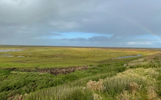
What can Morecambe Bay learn from the Netherlands?
Travelling sustainably to and from Amsterdam, Joseph – Our Future Coast Engagement Officer - toured the Netherlands with external colleagues to learn how the Dutch are using Nature Based Solutions to manage a changing coast. In a country where around one third of the land is below sea level, the trip highlighted the vulnerability of the Netherlands to rising sea levels, but also demonstrated how working in harmony with salt marshes and sand dunes can deliver benefits for people, flood reduction and wildlife.
Returning to the UK, Joseph reflects on the week’s highlights and the learning that can be contributed to the 'Our Future Coast' project and Morecambe Bay.
What can Morecambe Bay learn from the Netherlands?
Discover why Joseph's – Our Future Coast Engagement Officer – incredible week in the Netherlands, visiting Nature Based Solutions, is relevant to Morecambe Bay.
The Netherlands
With around one third of its land area below sea level, the Netherlands faces a constant battle to protect its coastline from flooding. Consequently, flooding and storms are ingrained on the national conscience, with vast areas of land being manipulated and altered to balance the input and output of water. As a result, the Dutch coastline hosts a complex network of dykes, dams, barriers and pumps.
But, with rising sea levels, building ever higher dykes is unsustainable and contributes to the loss of vital intertidal habitat. Instead, innovative techniques are needed that work with the natural environment and reduce the risk of flooding. In recent years, the Dutch have invested heavily in such techniques, or ‘Nature Based Solutions’.
Joseph – Our Future Coast Engagement Officer – had the incredible opportunity to spend a week in the Netherlands visiting several exemplar Nature Based Solutions with colleagues from the RSPB and Nature North. Returning to the UK after his low-carbon journey to and from the Netherlands using ferries, trains and buses, Joseph reflects on the week’s highlights.
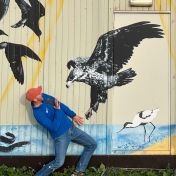
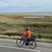
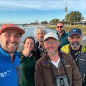
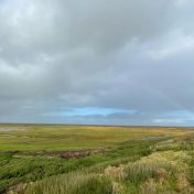
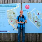
Marker Wadden – an artificial archipelago for birds
The Markermeer, a vast freshwater lake to the east of Amsterdam, was once part of a dynamic estuary connected to the North Sea. However, the construction of a series of dikes transformed it into a stagnant lake, cutting it off from tidal action and leading to significant challenges, including poor water quality and the loss of natural intertidal habitat.
To tackle these issues, an innovative solution was implemented: the creation of the Marker Wadden, a remarkable chain of islands built using sediment dredged from the Markermeer lake. This ‘artificial archipelago’ consists of a mosaic of habitats, including beaches, dunes, marshes, and wetlands, that serve as vital breeding and resting grounds for a host of diverse bird species.
Situated far from the mainland, the islands are beyond the reach of land-based predators, offering a haven for bird populations to flourish. The result is an ecological sanctuary, teeming with birds in both abundance and variety, demonstrating the possibilities for nature to rebound so rapidly when given safe spaces.
Texel - an island below the sea
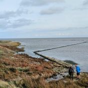
In the north of the Netherlands, within the Wadden Sea, lies the island of Texel. Much of its land area is below sea level, requiring a combination of dikes and dunes to protect its inhabitants from storm surges and flooding. However, the increasing intensity of storms driven by climate change has made these defences increasingly vulnerable.
The Prins Hendrik Sand Dike is an example of how engineered structures and the natural environment can work together to manage increasing flood risk on Texel. Instead of continually raising the dike’s height, sand dunes were created in front of it using dredged material. These dunes act as a natural buffer to wave energy and provide crucial habitat for wildlife.
People are restricted from accessing parts of the dunes to allow nature and birds to thrive. However, an accessible path meanders along the top of the dike and dune system, offering people the opportunity to walk and cycle within the environment. It is a fantastic example of how people and nature can co-exist within coastal edgelands, offering ideas for how such spaces could be created around our own Morecambe Bay.
Sigma Plan – managing flooding on the catchment scale
The terms ‘from source to sea’ and ‘catchment scale’ are commonly used in flood risk management, but few examples around Morecambe Bay can claim to achieve such ambition. However, the Sigma Plan, a large-scale vision for managing flooding in the Netherlands and Belgium from the River Scheldt and its tributaries can claim to be truly source to sea.
The Plan consists of a patchwork of nature-based solutions across the catchment that store and hold water on the land. Together, these areas provide vital flood buffers during storm surges and heavy rainfall, ensuring flood waters are kept away from large urbanised and industrial areas like the port of Antwerp.
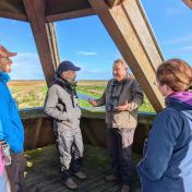
We visited several nature-based solution sites within the Sigma Plan, including the Hedwige-Prosper Project and the Polders of Kruibeke. Despite facing intense local resistance, particularly regarding the sense that the Plan is ‘giving up land’, the Plan has proved a resounding success and is now an integral and well-loved part of the landscape. Again, these places balance human recreation, flood alleviation and nature – providing sanctuaries for many rare bird populations to rebound in short periods of time.
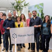
Reflections and applications for Morecambe Bay
Reflecting across the week, we were left inspired by the scale and vision of Nature Based Solutions in the Netherlands. The benefits for people and nature from such schemes were so clear to see, with the speed of ecological recovery particularly astounding. The trip left us all with a strong motivation to think big and apply the learning to our own work managing flooding and coastal change across North West England.
Low Carbon Travel to the Netherlands - Why?
To help tackle climate change, Joseph made his trip to the Netherlands via low carbon travel options. Rather than flying to the Netherlands - a high carbon emissions option - Joseph opted for low carbon travel. Joseph's outgoing journey took the train from Lancaster to Carlisle to Newcastle, the metro from central Newcastle to the ferry terminal at North Shields and then a ferry from Newcastle to Amsterdam. This journey took 23 hours showing Joseph's commitment to reducing our impact on the environment. Joseph's flight-free return journey was made by train taking the Eurostar from Amsterdam to London & a train up north to Lancaster.
The journey was estimated to release 36 tonnes of carbon compared with 182 tonnes if Joseph had travelled by plane.
Picture credits, Gallery 1: Wardill, then Joseph Earl (images 2, 3 and 4)
Picture credits: Gallery 2: All Stefan Ivanovic

